Services
Land Surveying, Subdivisions/Consolidations & Construction Layout
AquaEconomics boasts over 80 years of combined surveying expertise, providing services ranging from title surveys and plot plans to intricate subdivisions and construction staking/layout. Whether you require a slope analysis in Philadelphia or assistance with a property line dispute in the surrounding suburbs, our experienced team is here to assist you.
Philadelphia Stormwater Bill Reduction
AquaEconomics understands the increased costs incurred by large landowners within Philadelphia. We specialize in reducing water bills for large properties and offer a complimentary water billing analysis service. With an in-depth understanding of Philadelphia's water system, our team can help you take control of your costs.
Site Engineering, Land Development & Stormwater Management
AquaEconomics offers comprehensive civil and site engineering services in Philadelphia and surrounding areas. With a diverse portfolio spanning from residential to large-scale development projects, we specialize in stormwater management, permitting, and green infrastructure solutions. Whether you're a homeowner, investor, or developer, we provide tailored engineering expertise for all your project needs.
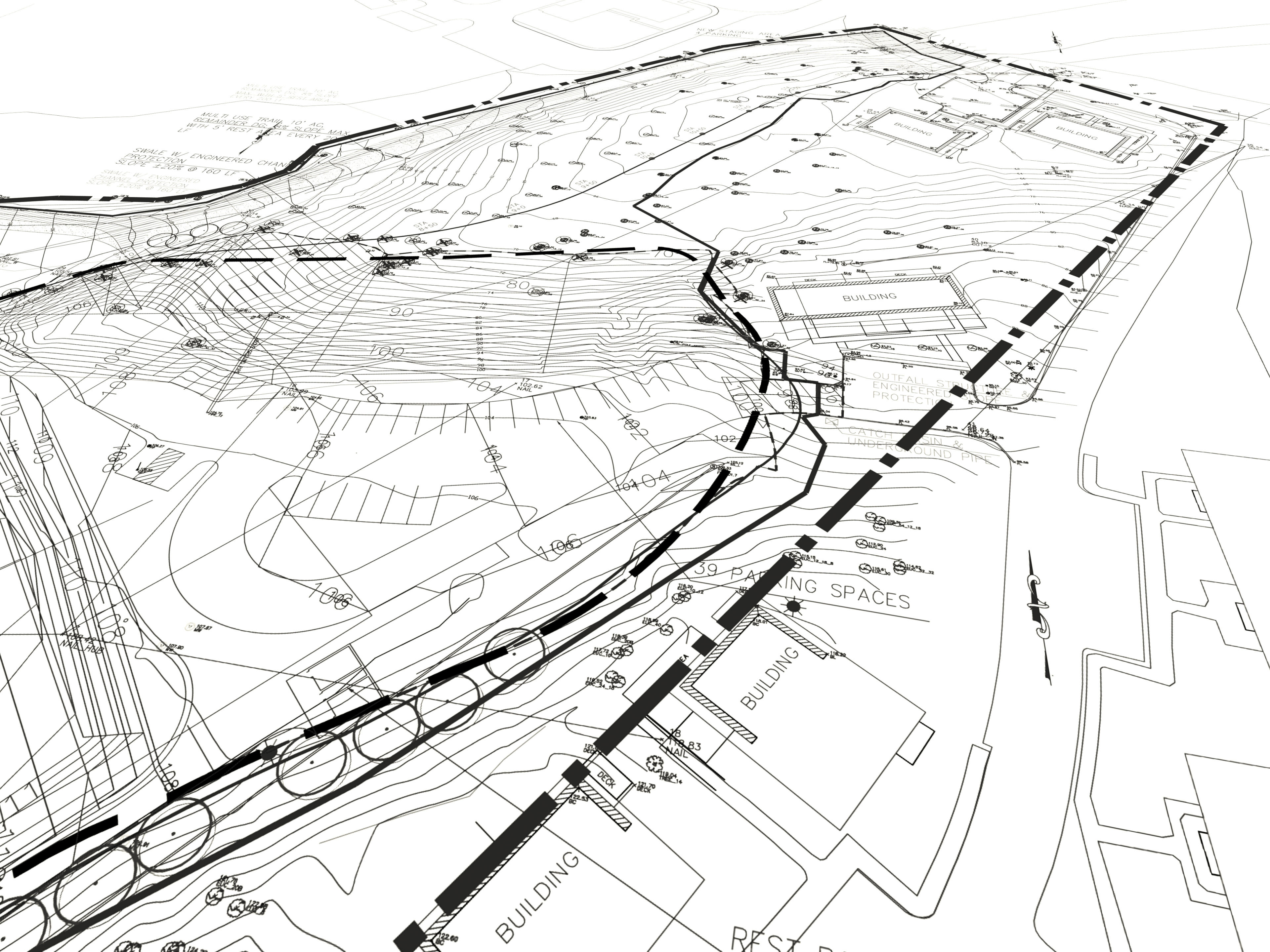
Land Surveying, Subdivisions/Consolidations & Construction Layout
Construction Layout & Stake out
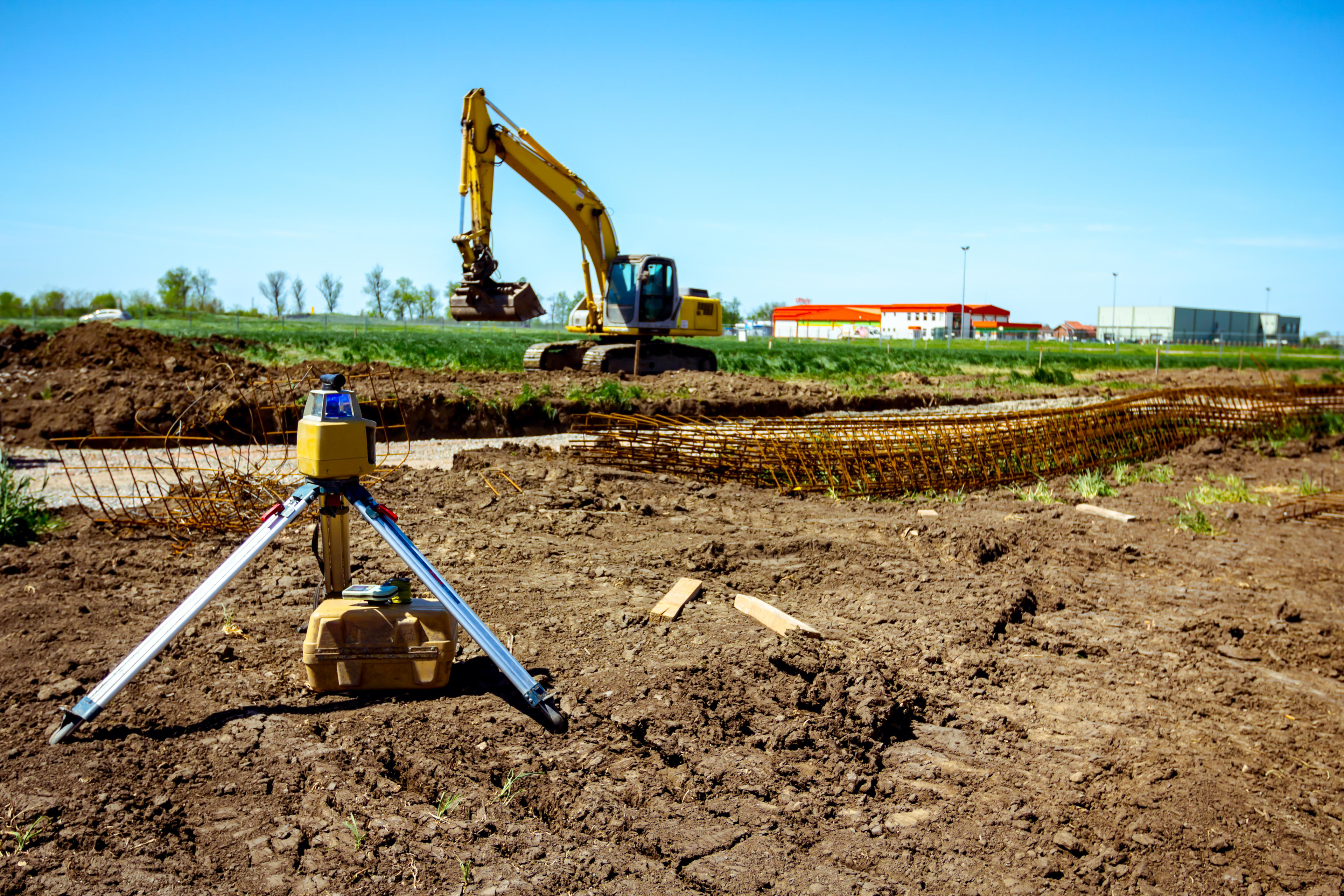
Map your property with precision.
A boundary survey locates, describes, and maps a parcel’s property lines as described in a deed. It also indicates any easements or encroachments and may show the limitations imposed on the property by state or local regulations. A boundary survey may be an original survey or a retracement survey.An original survey is a subdivision of land into smaller tracts, such as the original warrant surveys for subdividing the lands of William Penn. Any subdivision of an existing tract of land is also an original survey. The performance of such a survey is dictated by the client’s needs, site considerations, state laws, and local ordinances governing subdivisions. However, before a tract of land can be subdivided, a retracement survey must establish its corners and boundaries.
A retracement survey re-establishes the corners and boundary lines of a parcel of land previously surveyed. This involves thorough research of both public and private records to arrive at a proper description of the property. Often the surveyor must include a historical analysis of property configurations in the general area. Such research may involve public records in other county courthouses or even original warrant tracts. Angular and linear measurements locating existing property corners and other evidence of ownership are then correlated with this title research.Howell thoroughly researches the historical records relating to a property and often all lands surrounding it. After research, the field work begins—establishing a control network of known points which are then used to locate any existing monument points and other evidence of boundaries. Once this is completed, the survey team compiles all information in order to confirm their findings. They then return to the site and set the final monuments. In conclusion, our surveyors draft a plan, prepare a legal description, and provide a report.
service 8
Map your property with precision.
A boundary survey locates, describes, and maps a parcel’s property lines as described in a deed. It also indicates any easements or encroachments and may show the limitations imposed on the property by state or local regulations. A boundary survey may be an original survey or a retracement survey.An original survey is a subdivision of land into smaller tracts, such as the original warrant surveys for subdividing the lands of William Penn. Any subdivision of an existing tract of land is also an original survey. The performance of such a survey is dictated by the client’s needs, site considerations, state laws, and local ordinances governing subdivisions. However, before a tract of land can be subdivided, a retracement survey must establish its corners and boundaries.
A retracement survey re-establishes the corners and boundary lines of a parcel of land previously surveyed. This involves thorough research of both public and private records to arrive at a proper description of the property. Often the surveyor must include a historical analysis of property configurations in the general area. Such research may involve public records in other county courthouses or even original warrant tracts. Angular and linear measurements locating existing property corners and other evidence of ownership are then correlated with this title research.Howell thoroughly researches the historical records relating to a property and often all lands surrounding it. After research, the field work begins—establishing a control network of known points which are then used to locate any existing monument points and other evidence of boundaries. Once this is completed, the survey team compiles all information in order to confirm their findings. They then return to the site and set the final monuments. In conclusion, our surveyors draft a plan, prepare a legal description, and provide a report.
Philadelphia Stormwater Bill Reduction
Site Engineering, Land Development & Stormwater Management
service 3
Map your property with precision.
A boundary survey locates, describes, and maps a parcel’s property lines as described in a deed. It also indicates any easements or encroachments and may show the limitations imposed on the property by state or local regulations. A boundary survey may be an original survey or a retracement survey.An original survey is a subdivision of land into smaller tracts, such as the original warrant surveys for subdividing the lands of William Penn. Any subdivision of an existing tract of land is also an original survey. The performance of such a survey is dictated by the client’s needs, site considerations, state laws, and local ordinances governing subdivisions. However, before a tract of land can be subdivided, a retracement survey must establish its corners and boundaries.
A retracement survey re-establishes the corners and boundary lines of a parcel of land previously surveyed. This involves thorough research of both public and private records to arrive at a proper description of the property. Often the surveyor must include a historical analysis of property configurations in the general area. Such research may involve public records in other county courthouses or even original warrant tracts. Angular and linear measurements locating existing property corners and other evidence of ownership are then correlated with this title research.Howell thoroughly researches the historical records relating to a property and often all lands surrounding it. After research, the field work begins—establishing a control network of known points which are then used to locate any existing monument points and other evidence of boundaries. Once this is completed, the survey team compiles all information in order to confirm their findings. They then return to the site and set the final monuments. In conclusion, our surveyors draft a plan, prepare a legal description, and provide a report.
service 6
Map your property with precision.
A boundary survey locates, describes, and maps a parcel’s property lines as described in a deed. It also indicates any easements or encroachments and may show the limitations imposed on the property by state or local regulations. A boundary survey may be an original survey or a retracement survey.An original survey is a subdivision of land into smaller tracts, such as the original warrant surveys for subdividing the lands of William Penn. Any subdivision of an existing tract of land is also an original survey. The performance of such a survey is dictated by the client’s needs, site considerations, state laws, and local ordinances governing subdivisions. However, before a tract of land can be subdivided, a retracement survey must establish its corners and boundaries.
A retracement survey re-establishes the corners and boundary lines of a parcel of land previously surveyed. This involves thorough research of both public and private records to arrive at a proper description of the property. Often the surveyor must include a historical analysis of property configurations in the general area. Such research may involve public records in other county courthouses or even original warrant tracts. Angular and linear measurements locating existing property corners and other evidence of ownership are then correlated with this title research.Howell thoroughly researches the historical records relating to a property and often all lands surrounding it. After research, the field work begins—establishing a control network of known points which are then used to locate any existing monument points and other evidence of boundaries. Once this is completed, the survey team compiles all information in order to confirm their findings. They then return to the site and set the final monuments. In conclusion, our surveyors draft a plan, prepare a legal description, and provide a report.
service 5
Map your property with precision.
A boundary survey locates, describes, and maps a parcel’s property lines as described in a deed. It also indicates any easements or encroachments and may show the limitations imposed on the property by state or local regulations. A boundary survey may be an original survey or a retracement survey.An original survey is a subdivision of land into smaller tracts, such as the original warrant surveys for subdividing the lands of William Penn. Any subdivision of an existing tract of land is also an original survey. The performance of such a survey is dictated by the client’s needs, site considerations, state laws, and local ordinances governing subdivisions. However, before a tract of land can be subdivided, a retracement survey must establish its corners and boundaries.
A retracement survey re-establishes the corners and boundary lines of a parcel of land previously surveyed. This involves thorough research of both public and private records to arrive at a proper description of the property. Often the surveyor must include a historical analysis of property configurations in the general area. Such research may involve public records in other county courthouses or even original warrant tracts. Angular and linear measurements locating existing property corners and other evidence of ownership are then correlated with this title research.Howell thoroughly researches the historical records relating to a property and often all lands surrounding it. After research, the field work begins—establishing a control network of known points which are then used to locate any existing monument points and other evidence of boundaries. Once this is completed, the survey team compiles all information in order to confirm their findings. They then return to the site and set the final monuments. In conclusion, our surveyors draft a plan, prepare a legal description, and provide a report.